
Top 10 Magnificent Vietnam Mountain Passes for Motorbike Tours
Vietnam stretches from sea level rice paddies along the Mekong Delta to ridgelines cresting above 2,000 meters in the northern highlands, and few vehicles translate that vertical shift into sensation the way a motorbike does. Wind, temperature drops, tight hairpin radius, and shifting cloud cover register directly on the rider, turning a magnificent vietnam mountain pass into a layered experience rather than a scenic checkpoint you drive past. Below, we map ten passes across four geographic zones, the northwest loop, the northeast frontier, the central coast, and the Central Highlands, each chosen for a distinct road character and payoff. Every entry covers the precise location, real riding difficulty, signature scenery worth pulling over for, and the months when conditions favor the throttle. Read on for the practical map before deciding which mountain pass for motorbike tour in Vietnam deserves a slot on your itinerary.
Why Vietnam Mountain Passes Are a Mecca for Motorbike Riders
A vietnam mountain pass compresses dramatic elevation shifts into short rides, so one morning can move you from river valleys into cloud forest. Riders thread hairpins cut into hillsides rather than tunnels, passing ethnic minority villages from the saddle and crossing microclimates that shift every few kilometers. Most routes feed into loops like Ha Giang, the Northwest, Ho Chi Minh Trail, and Central Highlands, where rentals, mechanics, and homestays are well developed.
Top 10 Magnificent Vietnam Mountain Passes for Motorbike Tours
From the frosty ridgelines above Sapa to the cliff roads of Ha Giang, the following ten passes trace Vietnam’s most spectacular mountain riding, ordered from north to south.
O Quy Ho Pass (Lao Cai, near Sapa)
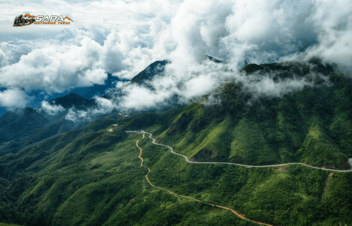
At roughly 50 km, O Quy Ho is the longest continuous mountain pass in Vietnam, threading between Sapa and Lai Chau through pine forest and switchbacks that climb above the cloud line. Thick fog banks can drop visibility within minutes, and a sheer cliff edge at the summit opens toward Fansipan on clear mornings. The pass has earned the nickname “Pass of Death” because of its accident record.
- Altitude: summit near 2,000 m
- Best season: September to November or March to May
- Difficulty: challenging
Ma Pi Leng Pass (Ha Giang)
The headline 20 km of the Ha Giang motorbike loop, Ma Pi Leng clings to a limestone wall roughly 1,200 m above the emerald Nho Que River, with the Tu San gorge dropping below and H’mong and Dao villages lining the rim above. The pink buckwheat fields frame the switchbacks between late September and December, while foreign riders must carry the mandatory Ha Giang permit.
- Length: about 20 km of cliff-hugging road
- Best season: October to December
- Difficulty: moderate, though exposure feels intense
Pha Din Pass (Son La to Dien Bien Phu)
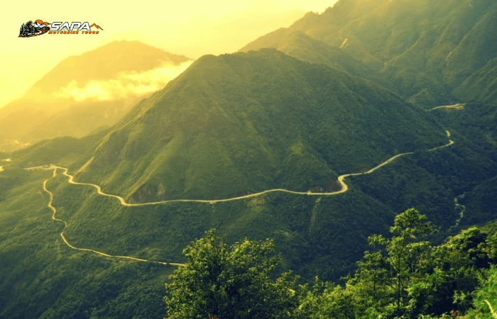
Pha Din runs along Highway 6 between Son La and Dien Bien Phu. The crest sits near 1,648 meters across 32 kilometers of constant curves. Pine forests and shifting mist shape the ride, and the ridgeline echoes the 1954 campaign. The surface mixes patched asphalt with loose gravel. Early mornings reveal tea estates far below.
Length: 32 km
Best season: October to April
Difficulty: moderate; livestock crossings demand caution
Khau Pha Pass (Yen Bai, Mu Cang Chai)
Khau Pha is among Vietnam’s highest paved roads, cresting near 1,545 meters above the Mu Cang Chai terraces. Switchbacks tighten as fog rolls in, and riders prefer a north-to-south descent. The climb is steep for several kilometers, so second gear and engine braking matter. Hmong vendors serve hot tea by the viewpoint.
Length: about 30 km of switchbacks
Best season: late September to early October
Difficulty: challenging; sharp bends and mist
Thung Khe Pass (Hoa Binh, near Mai Chau)
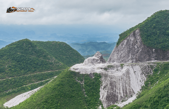
Known as White Stone Pass, Thung Khe rises sharply above the Mai Chau valley. Wind funnels along the ridge and pushes small bikes sideways. Winter fog can drop visibility below 20 meters, a real warning. The reward at the rim is an emerald valley dropping into another country.
Length: roughly 8 km
Best season: November to March
Difficulty: moderate; exposed at the summit
Me Pja Pass (Cao Bang)
Me Pja is a favorite of guides who know Cao Bang. The road climbs toward the Dong Khe frontier, weaving through karst peaks. Fresh asphalt alternates with crumbling concrete, and rain turns shoulders into mud slicks. The summit viewpoint peers into a bowl of jagged limestone.
Length: about 18 km
Best season: September to November
Difficulty: moderate; patchy signal along the ridge
Ma Phuc Pass (Cao Bang)
Ma Phuc, the Devil’s Face, earns its name on first sight. The grade cuts across the sky like a dark spine, with clouds snagging the ridgeline. Temperature drops sharply at the summit, and cross-gusts lean small bikes sideways. The descent toward Tra Linh reveals limestone forests that look prehistoric.
Length: about 22 km
Best season: October to December
Difficulty: advanced; weather shifts within minutes
Hai Van Pass (Da Nang to Hue)
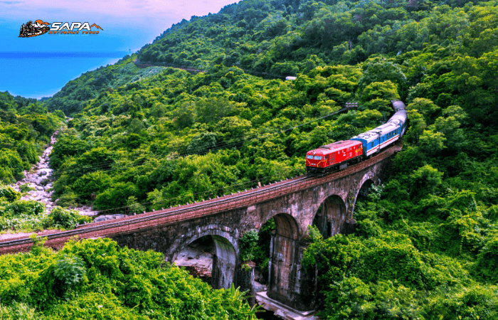
Hai Van climbs about 500 m between Da Nang and Hue across 21 km of switchback asphalt. On a clear day, Lang Co lagoon and jungle hills are visible far below. Fog drops in fast at the summit, cutting visibility to a few meters. Most trucks now use the Hai Van Tunnel, leaving the road quieter than a decade ago. Length: 21 km. Best season: March to May. Difficulty: moderate; sharp bends and tunnel traffic at the base.
Hon Giao Pass (Lam Dong, Da Lat)
Hon Giao tops Highway 20 at around 1,000 m, linking Di Linh to the Da Lat plateau. Pine forest gives way to coffee farms as the air cools. Wet weather makes the surface slick, and fast trucks descending are the real danger. Length: roughly 30 km. Best season: November to February. Difficulty: moderate to advanced; long climbs and sudden fog.
Mang Den Pass (Kon Tum, Central Highlands)
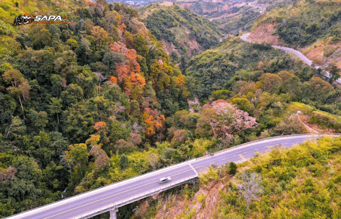
Mang Den is a quieter name on the motorbike map, winding through some of Kon Tum’s cleanest pine forest. Streams cross the road, temperatures sit well below the surrounding lowlands, and afternoon mist is common. Starting early means clearer mountain light. Length: about 25 km. Best season: December to March. Difficulty: easy to moderate; well-paved but several blind corners.
Practical Tips for Riding Vietnam Mountain Passes Safely
Experienced riders see preparation as part of the journey itself.
- Best months: north September to December; south December to April.
- Essential gear: rain jacket, fog lights, anti-fog visor, thermals, puncture kit.
- Fuel gaps: Ha Giang and Cao Bang have long stretches without stations.
- Ha Giang permit: required for foreign riders at certain checkpoints.
- Bike choice: semi-automatic trail bikes handle loose gravel better than scooters.
- Insurance: standard policies often exclude motorbike riding in Vietnam.
Frequently Asked Questions About Vietnam Mountain Passes
Riders planning their first vietnam mountain pass trip tend to ask the same two questions before committing to a motorbike tour: how risky is the road surface, and how high does the climb actually reach. The answers below address both directly, drawing on what guides see every season on the saddle, and they point readers back to the matching section above where relevant.
Which Vietnam mountain pass is the most dangerous for riders?
O Quy Ho remains the highest-risk vietnam mountain pass for foreign riders. Its unguarded drop-offs, thick fog rolling across the summit, and constant container-truck traffic leave almost no margin for error on a small-displacement bike. Khau Pha pushes steeper gradients over shorter sections, while Ma Phuc squeezes riders through tight hairpin bends that demand careful clutch and brake control, yet neither matches the combined exposure and heavy truck volume that define an O Quy Ho crossing in winter, when visibility drops below ten metres.
What is the highest mountain pass in Vietnam?
Two paved passes claim the highest elevation in Vietnam. Tram Ton, climbing beneath Fansipan near Sapa, briefly tops out higher than any other vietnam mountain pass on a sealed road, with summit markers reading roughly 1,900 metres above sea level. O Quy Ho, however, delivers the longer continuous ascent described earlier, offering sustained altitude, sharp switchbacks, and summit viewpoints that match Tram Ton’s for sheer scale and visibility on a clear morning.

When is the best time to ride Vietnam mountain passes?
Most riders target the dry season from October to April, when visibility is high and landslide risk drops across northern ranges. February and March stand out for cool temperatures and stable skies, though mornings can still carry fog at altitude. The July to August window introduces heavy monsoon rain, swollen rivers, and low cloud that closes upper pass sections. For central Vietnam, January through March works well, while southern highlands stay comfortable almost year round.
Do I need a permit for the Ha Giang mountain passes?
Yes. Foreign riders must secure a permit before entering the Dong Van Karst Plateau Geopark, which covers the Ha Giang loop including Ma Pi Leng Pass and the Du Gia border zone. Permits are issued at the Ha Giang City immigration office upon passport and visa presentation, typically processed within 30 minutes at roughly 230,000 VND. Without this document, you will be turned back at official checkpoints along the route consistently.
What is the easiest pass for first time riders in Vietnam?
Hai Van Pass between Hue and Da Nang offers the gentlest introduction to mountain riding in the country. The distance is manageable at roughly 21 kilometres, the surface is well maintained, and the gradient remains forgiving for novice operators. Traffic is light compared with northern alternatives, while ocean views and historical tunnels provide rewarding stops. Riders with basic scooter experience can complete the crossing comfortably in under two hours.
Can I rent a motorbike to ride these mountain passes?
Yes. Rental shops operate in Hanoi, Hoi An, Hue, Da Lat, and Sa Pa, offering semi-automatic, manual, and large displacement options suited to highland terrain. Daily rates range from 150,000 to 800,000 VND depending on engine size. For mountain routes, a 125cc to 150cc semi-automatic is the practical choice, balancing torque, weight, and control on steep gravel sections. Always inspect brakes, tyres, and lights before departure, and confirm whether roadside assistance is included.
How many days should I plan for a magnificent Vietnam mountain pass motorbike tour?
Trip length depends on how many crossings you want to combine. A single ascent such as Tram Ton or Hai Van fits comfortably into one day. The Ha Giang loop, covering Ma Pi Leng, Quan Ba, and Yen Minh, requires a minimum of three days and is more rewarding over four. For a comprehensive route linking Sa Pa, Ha Giang, and the central coast, plan ten to fourteen days to allow weather buffers, rest days, and cultural exploration.
Vietnam’s mountain passes deliver some of the most varied motorbike touring experiences in Southeast Asia, ranging from the dramatic coastal switchbacks of Hai Van and the remote limestone curves of Quang Binh to the high-altitude plateaux of Ha Giang and the cloud-forested ridges surrounding Sa Pa town. Selecting a magnificent Vietnam mountain pass depends less on online ranking lists and more on matching terrain difficulty, seasonal weather windows, and the cultural depth each rider hopes to find beyond the asphalt itself on the road. For travelers who prefer structured, well-supported itineraries with experienced local guides, reliable mechanical backup, and pre-vetted daily distances, the team at sapamotorbiketours.com organizes multi-day departures from Hanoi that cover several of the passes listed here with flexible scheduling and small group sizes.